Cultural Sites
Cultural Sites
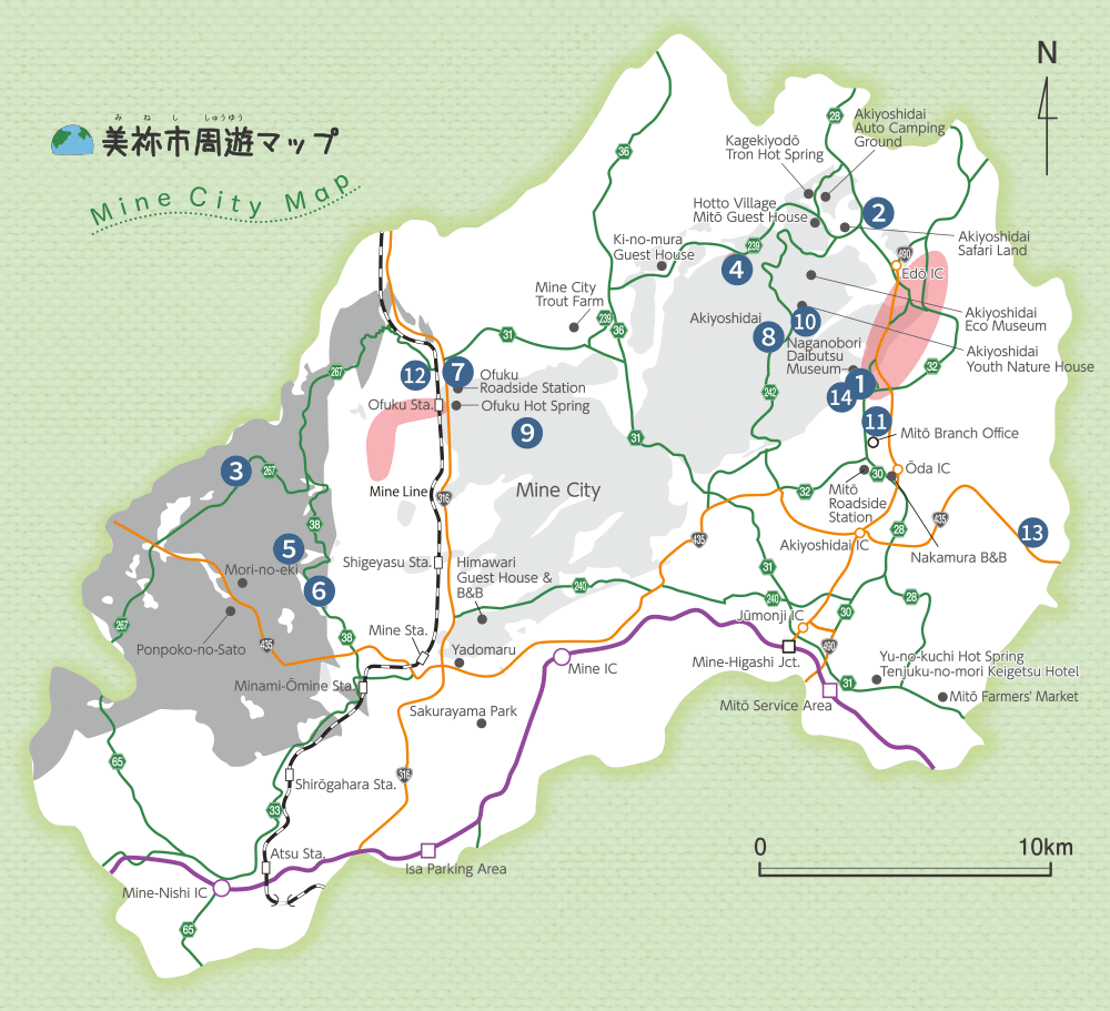
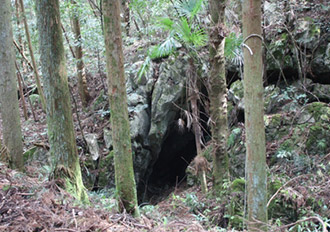
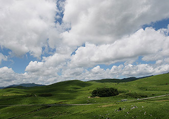
1.Naganobori Copper Mine Ruins
Cultural Sites
2.Suebara Kiln Ruins
These are the ruins of kilns that were used between the Nara period and towards the beginning of the Heian period to create sueki pottery. Five kilns have been discovered within a 16 m-long area east-west of the southern slope of the hill. Of these, two are built on top of each other and are extremely important ruins that show the chronology of sueki pottery. It has been suggested that the Suebara Kiln Ruins were established because of the Naganobori Copper Mine, and it is thought that a sixth kiln or perhaps more has not been discovered yet.
Cultural Sites
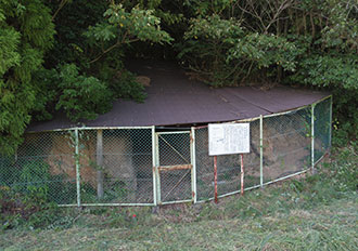
3.The Buddha in the wall of Mt Rakan, Ishiyakata
A number of Buddhas have been carved into the gigantic sandstones that can be found near the summit of the mountain. It is unknown when and why these Buddhas were created.
Cultural Sites
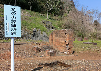
4.Aokage Silver Mine Ruins
Aokage Silver Mine is where the silver that was formed when limestone reacted with magma 100 million years ago was mined for a period of 66 years from 1537. The hole (mineshaft) that was dug here still remains, and places that were dug using a Japanese chisel can be seen on its wall. The hamlet at the foot of the mine still has place names and house names that date back to when the area was prosperous due to the silver mine. An old well also remains in the area.
Cultural Sites
5.Arakawa Horizontal Mine Ruins
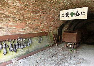
This is where the anthracite (coal that does not produce much smoke when burned) of Ōmine Coalfield was mined. This opening was completed in 1905 and is the oldest opening to the mine that still exists in the Ōmine Coalfield. It is a precious heritage that dates back to the Meiji period with red bricks that line the wall of the entrance. ※Visitors may enter the ruins only if they are accompanied by a geoguide.
Cultural Sites
6.Mine Inclined Mineshaft Ruins (Mugigawa)
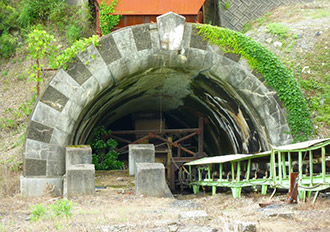
Mine Inclined Mineshaft is one of the most important mineshafts in the Ōmine Coalfield where anthracite (coal that does not produce much smoke when burned) was mined. A large amount of the coal that was mined underground was carried up to the ground through here. In the past there were many railway stations in the area which were used to transport coal.
Cultural Sites
7.The lime kiln ruins of Ofuku
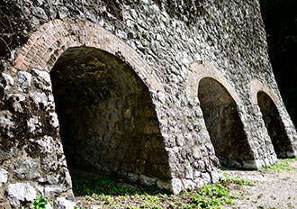
Lime was produced here from the middle of the Meiji period (1890s) to the middle of the Showa period (1950s). The lime was mined from the mountain on the south-east of the lime kilns, and anthracite that was used as a raw material was mined from the north-west. The lime that was produced was used as fertilizer for fields, an ingredient for cement, and as a construction material (cement plaster).
Cultural Sites
8.Chōjaga Forest
Chōjaga Forest is a primeval forest that has been left in its original state with approximately 66 types of plants. The tabunoki (Machilus thunbergii) is the most common type of plant that can be found in the forest, and many of them are approximately 16 m tall. The trees form a thick, tall tree layer as well as a sub-tree layer, and there is hardly any undergrowth on the ground. It is said that the forest is called Chōjaga Forest (“rich person’s forest”) because in the past a rich person decided to settle in this area and live in isolation from the rest of the world.
Cultural Sites
9.Yowara Uvala and Hamlet
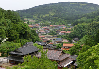
The Yowara area in Shūhō-chō is located in the western side of the Akiyoshidai Karst Plateau and is a hamlet that formed inside an uvala (a valley-like landform that is formed when multiple dolines combine). It is isolated from other hamlets, and houses and buildings are packed within a cone-shaped valley. Due to the karst landform there are no rivers that flow above ground, and rainwater flows vertically down the multiple swallow holes that can be found within the uvala. Therefore, the agriculture in this area is focused on dry-field farming, and hardly anyone grows rice in paddy fields.
Cultural Sites
10.The doline fields of Kaerimizu
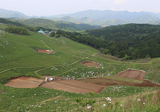
Doline fields are farmlands that are found at the bottom of dolines (cone-shaped depressions). The bottom of the dolines in Akiyoshidai Karst Plateau were cultivated as dry fields as early as the Edo period. The bottom of dolines is well-suited to growing crops as the surface is relatively flat and water drains well. However, such agricultural land was slowly abandoned when more machines began to be used for agriculture and large machinery were introduced, since cars and agricultural machinery could not enter the farmlands. Today, some local farmers that live near the dolines continue to grow crops in them such as burdock, taro and Chinese cabbage.
Cultural Sites
11.Kinrei Shrine
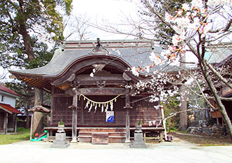
This area holds the ruins of the military campaign stronghold from the Ōda/Edō battle which Takasugi Shinsaku, Yamagata Aritomo, Itō Hirobumi and others used as the stronghold for their troops during a battle that occurred within the Chōshū Domain towards the end of the Edo period. It is also where they held strategy meetings and prayed for victory. The ruins are located to the north of a road in the Ōda area of Mitō-chō, where the Kinrei Shrine stands today.
Cultural Sites
12.Suijin Park (Guardian god for breast milk)
The stalactites of Suijin Park are worshipped as the guardian god for breast milk. When limestone (calcium carbonate) dissolves it becomes stalactites that grow like icicles. Because the stalactites look like a pair of breasts, it is believed that mothers of infants who drink this water will begin to produce breast milk or produce more breast milk than before.
Cultural Sites
13.The terraced paddy fields of Ōishi

These terraced paddy fields are located where a mountain valley opens up. There have been many instances in the past where dirt and water flowed down the valley. This type of flow is known as a debris flow, and this type of landform is known as debris flow alluvial fan. It is thought that the name of the area, Ōishi (“large stone”), probably dates back to a large stone that was carried there by the debris flow. The land is on an incline but the paddy fields were built in steps (terraced paddy fields) to allow people to grow rice.
Cultural Sites
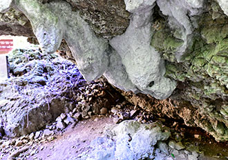
14.Kuzuga Hole
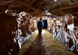
Kuzuga Hole is a limestone cave approximately 1 km in total length and is located near the water source for Mitō-chō’s simple water-supply system in Ōda, Mitō-chō. It is located in the upstream part of Akiyoshidō Cave and is connected to Akiyoshidō’s seventh main chamber. It is also connected to the mineshaft that was excavated as a waste-rock dump for Mizutamari Copper Mine, which was the last Naganobori Copper Mine to close. The horizontal hole, which is a natural cave, has been extended by human hands. Slags can be found near the entrance of the cave, and marachite and marble can be observed within the mineshaft. The entrance to the natural cave is a vertical hole with a height difference of 50 m.